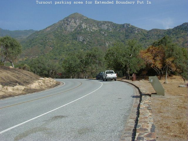
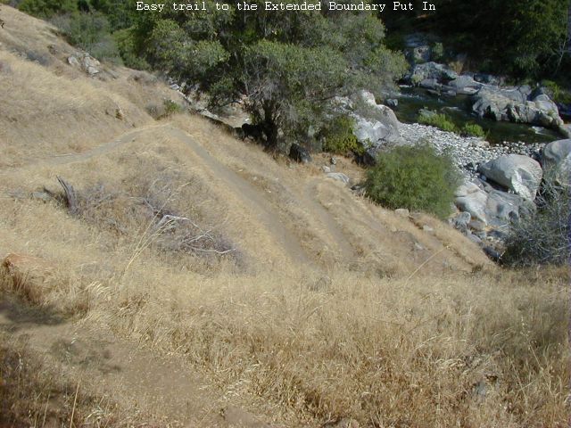
To get to putin, drive 0.7 miles past the entrance station into Sequoia National Park. Park on the right in the Turnout adjacent the sewage treatment plant. The trailhead is at the top end of the turnout. Take the easy Trail 1/4 mile and 200 vertical feet down to the river. The putin is anywhere in the pool below the Iron Lung Gorge. You can warm up with some cliff jumping from anywhere up to 70 feet.
This section is a logical extension to either the Park Boundary run below or the Ash Mountain run above. If you run the Ash Mountain section including the Iron Lung Gorge then you will undoubtably include the Extended Boundary as part of the run. The Extended Boundary is more difficult than the Park Boundary Run and has a narrower window. While the lowest boatable flow of this section is the same as the Park Boundary section, it's upper boatable level will be less unless you are willing to run some more difficult water. The Extended Boundary is seldom run becuase of it's difficulty and more likely due to lack of awareness of what it contains. Hopefully the publication of this log will increase the boater count on this section in the future.
All photos taken between 4.85 and 4.95 feet on the SCE Park Boundary Gauge (Approx 320 cfs in this section)
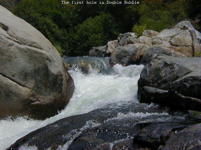
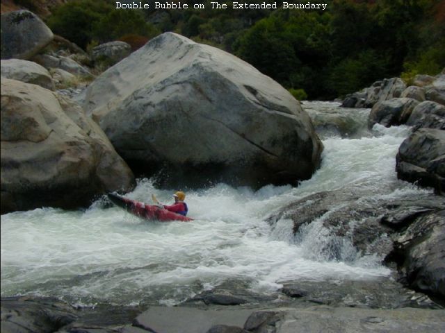 Double Bubble
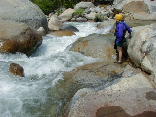
"Double Bubble" the Put-In drop (Class 4+)
A double drop going left to right around a giant boulder at the end of the put in pool. Stay left entering and coming out of the First Hole in order to stay off the wall on the right in the Second Hole
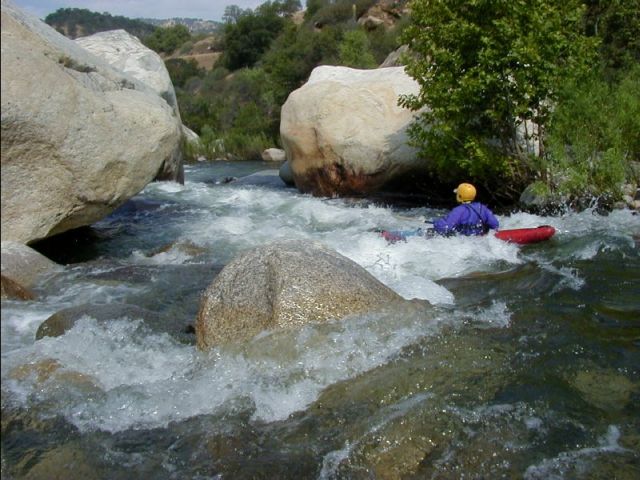
No Name (Class 3)
A 75 yard pool below Double Bubble leads to a class 3. Run right and eddy right below. The next big drop is 30 yards away.
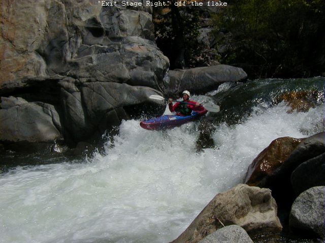 Exit Stage Right
Exit Stage Right (Class 4/4+)
Run off the flake of rock far right side.
 The Narrows
The Narrows (Class 4)
The river narrows to a few feet and drop 6 feet between solid granite. The exit is narrow too and a pretty good hole can be expected along with a possible back ender.
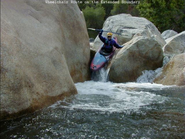
No Name (Class 3+)
A short rapid that will try to push you up against the left wall. Below this rapid a channel with less water goes far left of an island into the The Wheelchair Route which might be a good choice at higher water to avoid the Steep Slalom ahead.
Upper Slalom (Class 4)
 Upper Slalom
Run left in the first steep section then move right and then go left around the big boulders into the last real pool you will see for a while. Scout right.
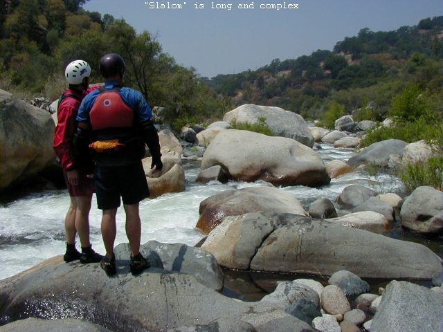 Slalom
Slalom (Class 4+/5)
A 200 yards long and complex rapid with some consequences for not executing precisely. Scout this one in it's entirety from the right bank.
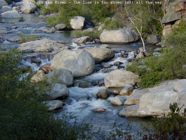
Crack in the River (Class 4)
 Crack in the River
Don't run the crack in the middle/right of the river. It is pin city in there. Scout the crack for the fun of it. Paddle back upstream and take the The Far River Left Channel all the way to the pool at the bottom.
Take Out - Indian Head Beach
Take out here or continue downstream into the Park Boundary Run. The Southern California Edison Diversion Dam is 150 yards downstream. An easy trail gains 100 feet elevation on it's way up to the Indian Head Parking Area
Continue upstream Ash Mountain Section (Class 5)
Continue downstream Park Boundary to Gateway (Class 4+)
Copyright © 2008 by Bill Pooley. All rights reserved.
This page is http://www.c2.com/kaweah/log_ironlung2pkbndry.html
Last modified: 07.03.08